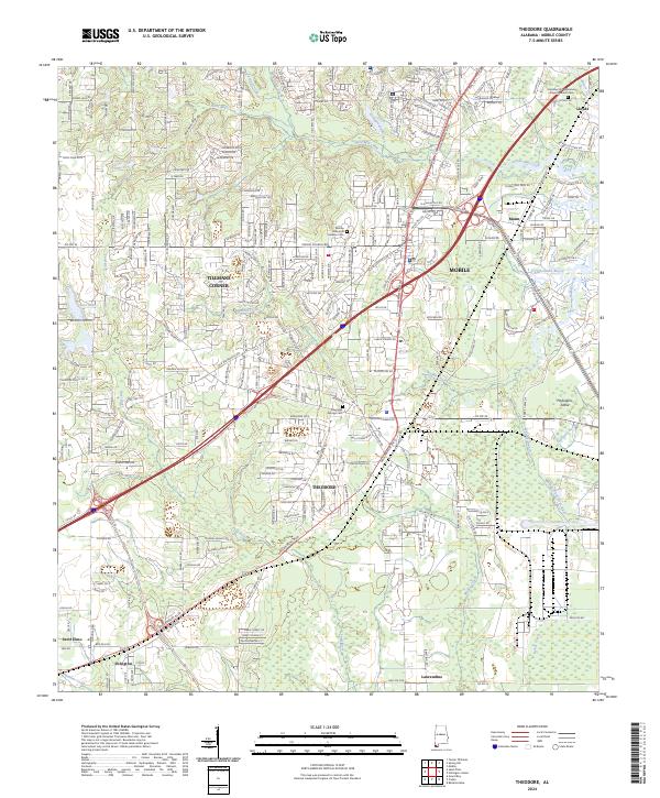
2024 Map of Theodore
USGS Topo · Published 2024About this map
Theodore and Tillmans Corner anchor a coastal landscape where the suburban expansion of Mobile meets the low-lying wetlands of the Alabama Gulf Coast. This area is defined by a dense network of waterways, including Halls Mill Creek and Rabbit Creek, which drain toward the bay through a complex of tidal marshes and bayous. The map captures the significant transportation corridors of Government Blvd and Theodore Dawes Rd as they navigate around the numerous branches and creeks that bisect the terrain.
Find a feature on this map
43 named features on this map. Tap any name to fly to it.
Don’t see what you’re looking for? This feature index may not catch every label — zoom into the map to look around manually.
Map Details
Editions of this 2024 Theodore Map
This is the sole edition of this map. No revisions or reprints were ever made.
Other maps of this area

1921 · Grand Bay
USGS Topo · 1:62,500

1921 · Delchamps
USGS Topo · 1:62,500

1922 · Mobile
USGS Topo · 1:62,500

1940 · Hollingers Island
USGS Topo · 1:31,680

1940 · Mobile
USGS Topo · 1:31,680

1940 · Mobile
USGS Topo · 1:62,500

1941 · Cedar Point
USGS Topo · 1:62,500

1941 · Hurley
USGS Topo · 1:62,500

1942 · Theodore
USGS Topo · 1:31,680

1943 · Cedar Point
USGS Topo · 1:62,500