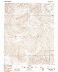
1988 Map of Thimble Peak
USGS Topo · Published 1988About this map
Leadfield sits as a high-altitude focal point within the high desert landscape of the Grapevine Mountains on the California-Nevada border. This 1988 provisional survey details the intricate drainage systems and steep ridgelines of Death Valley National Monument, where the steep descent of Titus Canyon is traced by the Titus Canyon Road (One Way). The presence of numerous prospects and name-specific geological features like Thimble Peak and Corkscrew Peak highlights the area's history of mineral exploration and rugged travel.
Find a feature on this map
19 named features on this map. Tap any name to fly to it.
Don’t see what you’re looking for? This feature index may not catch every label — zoom into the map to look around manually.
Map Details
Editions of this 1988 Thimble Peak Map
This is the sole edition of this map. No revisions or reprints were ever made.
Other maps of this area

1908 · Furnace Creek
USGS Topo · 1:250,000

1908 · Ballarat
USGS Topo · 1:250,000

1910 · Furnace Creek
USGS Topo · 1:250,000

1913 · Ballarat
USGS Topo · 1:250,000

1942 · Bullfrog
USGS Topo · 1:125,000

1948 · Death Valley
USGS Topo · 1:250,000

1952 · Chloride Cliff
USGS Topo · 1:50,000

1952 · Stovepipe Wells
USGS Topo · 1:62,500

1954 · Bullfrog
USGS Topo · 1:62,500

1954 · Death Valley
USGS Topo · 1:250,000