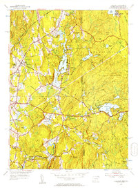
1955 Map of Thompson
USGS Topo · Published 1957This historical map portrays the area of Thompson in 1955, primarily covering Windham County as well as portions of Rhode Island. Featuring a scale of 1:24000, this map provides a highly detailed snapshot of the terrain, roads, buildings, counties, and historical landmarks in the Thompson region at the time. Published in 1957, it is one of 2 known editions of this map due to revisions or reprints.
Find a feature on this map
59 named features on this map. Tap any name to fly to it.
Don’t see what you’re looking for? This feature index may not catch every label — zoom into the map to look around manually.
Map Details
Editions of this 1955 Thompson Map
2 editions found
Historical Maps of Killingly Through Time
28 maps found

1889 Putnam
Windham County, CT

1892 Woodstock
Windham County, CT

1893 Putnam
Windham County, CT

1919 Putnam
Windham County, CT

1921 Woodstock
Windham County, CT

1943 Plainfield
Windham County, CT

1944 Hampton
Windham County, CT

1944 Oneco
Windham County, CT

1945 Eastford
Windham County, CT

1945 East Killingly
Windham County, CT

1945 Putnam
Windham County, CT

1945 Westford
Windham County, CT

1946 Scotland
Windham County, CT

1950 East Killingly
Windham County, CT

1952 Westford
Windham County, CT

1953 Eastford
Windham County, CT

1953 Hampton
Windham County, CT

1953 Oneco
Windham County, CT

1953 Plainfield
Windham County, CT

1953 Scotland
Windham County, CT

1955 East Killingly
Windham County, CT

1955 Putnam
Windham County, CT

1955 Thompson
Windham County, CT

1983 Eastford
Windham County, CT

1983 Plainfield
Windham County, CT

1983 Scotland
Windham County, CT

1983 Westford
Windham County, CT

1984 Hampton
Windham County, CT