
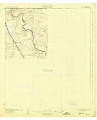
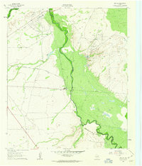
1968 Map of Threemile Draw
USGS Topo · Published 1971About this map
Charlie Ross Draw and the adjacent Threemile Draw snake through this corner of Reeves County, defining a landscape shaped by intermittent water and ranching infrastructure. This late-1960s survey documents a region where life and industry depend on scattered water sources and wind power. Family and place names are attached to essential landmarks, such as Charlie Ross Tank, Fourmile Tank, and Hackberry Tank.
Find a feature on this map
19 named features on this map. Tap any name to fly to it.
Don’t see what you’re looking for? This feature index may not catch every label — zoom into the map to look around manually.
Map Details
Editions of this 1968 Threemile Draw Map
This is the sole edition of this map. No revisions or reprints were ever made.
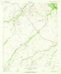
Other maps of this area
1931 · Orla
USGS Topo · 1:62,500

1954 · Van Horn
USGS Topo · 1:250,000

1954 · Pecos
USGS Topo · 1:250,000

1957 · Pecos
USGS Topo · 1:250,000

1958 · Van Horn
USGS Topo · 1:250,000
1961 · Orla SE
USGS Topo · 1:24,000
1961 · Narrow Bow Draw
USGS Topo · 1:24,000

1968 · Orla
USGS Topo · 1:24,000

1968 · W T Ranch
USGS Topo · 1:24,000

1968 · Halamicek Ranch
USGS Topo · 1:24,000