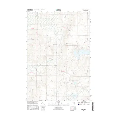
2017 Map of Thumb Lake
USGS Topo · Published 2017About this map
Chandler Hills and the prominent peak of Thunder Mtn define this northern Michigan landscape within Chandler Township. The area is a significant hydrological divide, where the headwaters of the N Br Boyne River and S Br Spring Brook flow westward, while the W Br Sturgeon River drains to the southeast. Recreational routes like the N Country National Scenic Trail and the Spring Brook Pathway traverse the varying elevations, connecting numerous small water bodies such as Thumb Lake, Kidney Lake, and Bows Lake. For genealogists, the map preserves the exact locations of three local burial grounds: Chandler Cem, Howard Cem, and Hudson Cem. This modern survey details the intricate network of local roads and trails, including Pioneer Trl and Jenkins Rd, providing a clear view of contemporary land use in Charlevoix County.
Find a feature on this map
62 named features on this map. Tap any name to fly to it.
Don’t see what you’re looking for? This feature index may not catch every label — zoom into the map to look around manually.
Map Details
Editions of this 2017 Thumb Lake Map
This is the sole edition of this map. No revisions or reprints were ever made.
Other maps of this area

1954 · Gaylord
USGS Topo · 1:62,500

1955 · Cheboygan
USGS Topo · 1:250,000

1957 · Wolverine
USGS Topo · 1:62,500

1958 · Cheboygan
USGS Topo · 1:250,000

1958 · Petoskey
USGS Topo · 1:62,500

1961 · Boyne Falls
USGS Topo · 1:62,500

1975 · Petoskey SW
USGS Topo · 1:24,000
1975 · Gaylord SW
USGS Topo · 1:24,000

1982 · Petoskey
USGS Topo · 1:100,000
1983 · Epsilon
USGS Topo · 1:25,000
Featured Places
- Chandler Township, MI
- Melrose Township, MI
- Hudson Township, MI
- Boyne Valley Township, MI
- Charlevoix County, MI