
1958 Map of Petoskey
USGS Topo · Published 1959About this map
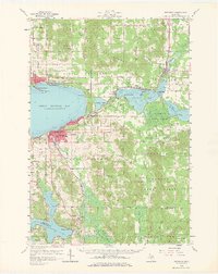
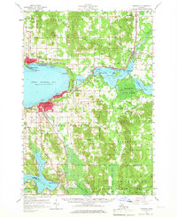
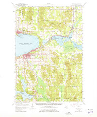
Petoskey serves as the regional anchor on this 1950s survey, centered where the Pennsylvania railroad meets the southern shore of Little Traverse Bay. The map highlights a coastal landscape defined by summer resorts and year-round settlements, from the enclave at Bay View to the established harbor at Harbor Springs. Transport and industry are evident in the rail lines tracing the shoreline and the numerous Gravel Pits scattered inland, while the Harbor Springs Airport and the Radio Tower (WKBZ) signal mid-century infrastructure growth.
Find a feature on this map
73 named features on this map. Tap any name to fly to it.
Don’t see what you’re looking for? This feature index may not catch every label — zoom into the map to look around manually.
Map Details
Editions of this 1958 Petoskey Map
4 editions found
Other maps of this area

1954 · Gaylord
USGS Topo · 1:62,500

1955 · Cheboygan
USGS Topo · 1:250,000

1957 · Wolverine
USGS Topo · 1:62,500

1957 · Mullett Lake
USGS Topo · 1:62,500

1958 · Cheboygan
USGS Topo · 1:250,000

1958 · Cross Village
USGS Topo · 1:62,500

1958 · Pellston
USGS Topo · 1:62,500

1958 · Bayshore
USGS Topo · 1:62,500

1961 · Boyne Falls
USGS Topo · 1:62,500

1961 · Boyne City
USGS Topo · 1:62,500