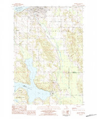
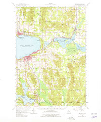
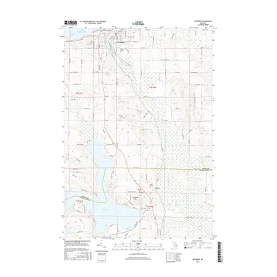
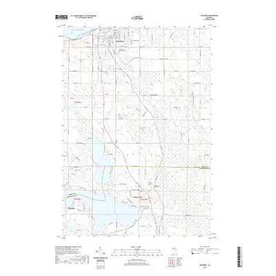
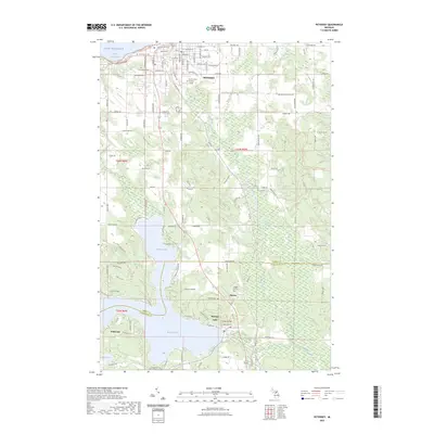
1983 Map of Petoskey
USGS Topo · Published 1984About this map
Petoskey serves as a prominent harbor hub along the southern shores of Little Traverse Bay in the early 1980s. The landscape transition from the urban grid and institutional landmarks, such as Little Traverse Hosp and North Central Michigan College, to the rural interiors of Bear Creek and Melrose is clearly defined. The Bear River flows north toward Lake Michigan, while the southern portion of the sheet is dominated by the intricate shoreline of Walloon Lake, including the settlement of Wildwood.
Find a feature on this map
37 named features on this map. Tap any name to fly to it.
Don’t see what you’re looking for? This feature index may not catch every label — zoom into the map to look around manually.
Map Details
Editions of this 1983 Petoskey Map
This is the sole edition of this map. No revisions or reprints were ever made.
Historical Maps of Petoskey Through Time
8 maps found

Featured Locations
- Bear Creek Township, MI
- Petoskey, MI
- Melrose Township, MI
- Bay Township, MI
- Walloon Lake, Melrose Township