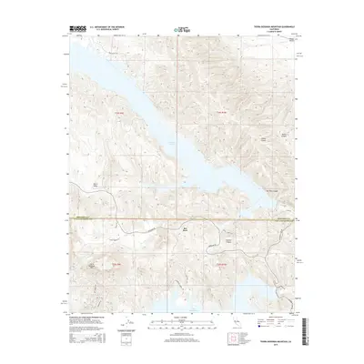
2015 Map of Tierra Redonda Mountain
USGS Topo · Published 2015About this map
The boundary between Monterey and San Luis Obispo counties bisects this 2015 survey, dominated by the expansive reaches of Lake San Antonio and Lake Nacimiento. The landscape is defined by a series of dramatic canyons and high ridges, notably the prominent summit of Tierra Redonda Mtn in the southwestern quadrant. Residential development is clustered near the water, particularly along Oak Shores Dr and Nacimiento Shores Rd, while the settlement of Bee Rock serves as a small inland hub. The map illustrates a complex topography where fertile depressions like Harris Valley and Hames Valley meet steep drainages such as Bee Rock Canyon and Sulphur Canyon. The transport network, including Interlake Rd and Nacimiento Lake Dr, follows the natural contours of the land, providing access to these significant reservoir areas.
Find a feature on this map
28 named features on this map. Tap any name to fly to it.
Don’t see what you’re looking for? This feature index may not catch every label — zoom into the map to look around manually.
Map Details
Editions of this 2015 Tierra Redonda Mountain Map
This is the sole edition of this map. No revisions or reprints were ever made.
Other maps of this area

1919 · Bryson
USGS Topo · 1:62,500

1919 · Bradley
USGS Topo · 1:62,500

1919 · Adelaida
USGS Topo · 1:62,500

1919 · San Simeon
USGS Topo · 1:62,500

1932 · Adelaida
USGS Topo · 1:62,500

1937 · San Simeon
USGS Topo · 1:62,500

1941 · Bradley
USGS Topo · 1:62,500

1941 · Bryson
USGS Topo · 1:62,500

1942 · Adelaida
USGS Topo · 1:62,500

1942 · Bryson
USGS Topo · 1:62,500