2024 Map of Tilden
USGS Topo · Published 2024About this map
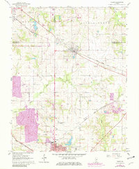
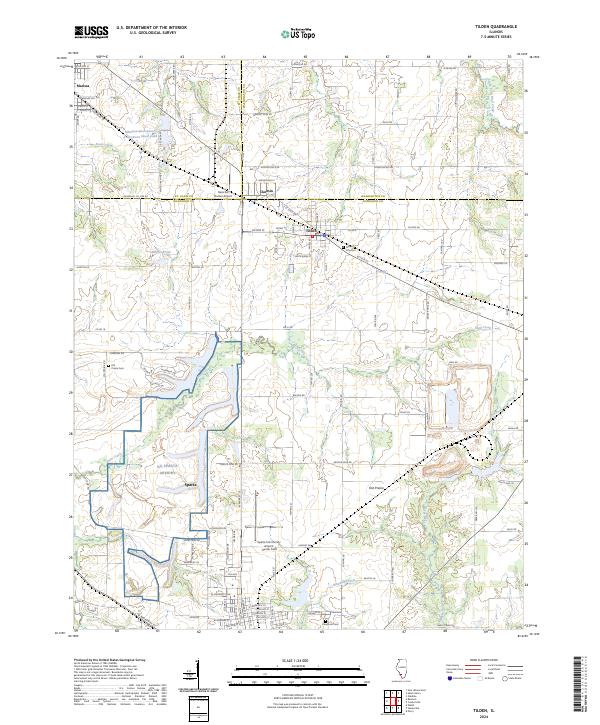
Tilden and Sparta anchor this Illinois landscape where the borders of Randolph, St. Clair, and Washington counties meet. The terrain is defined by the broad expanse of Flat Prairie and a network of waterways including Plum Creek and Doza Creek. Local infrastructure reflects a mix of civic and industrial history, from the NG Sparta Armory and Sparta Community Airport- Hunter Field to names like Peabody Mine Rd and White Oak Mine Rd that point toward the region's coal mining heritage. Genealogists will find several notable burial sites throughout the quadrangle, including Tilden City Cem, Hill Prairie Cem, and Caledonia Cem. Small settlements like Clarmin and Marissa sit alongside rural landmarks such as Shaufler Pond, illustrating the transition between concentrated village centers and the surrounding agricultural bottomlands of the Marys River watershed.
Find a feature on this map
75 named features on this map. Tap any name to fly to it.
Don’t see what you’re looking for? This feature index may not catch every label — zoom into the map to look around manually.
Map Details
Editions of this 2024 Tilden Map
This is the sole edition of this map. No revisions or reprints were ever made.