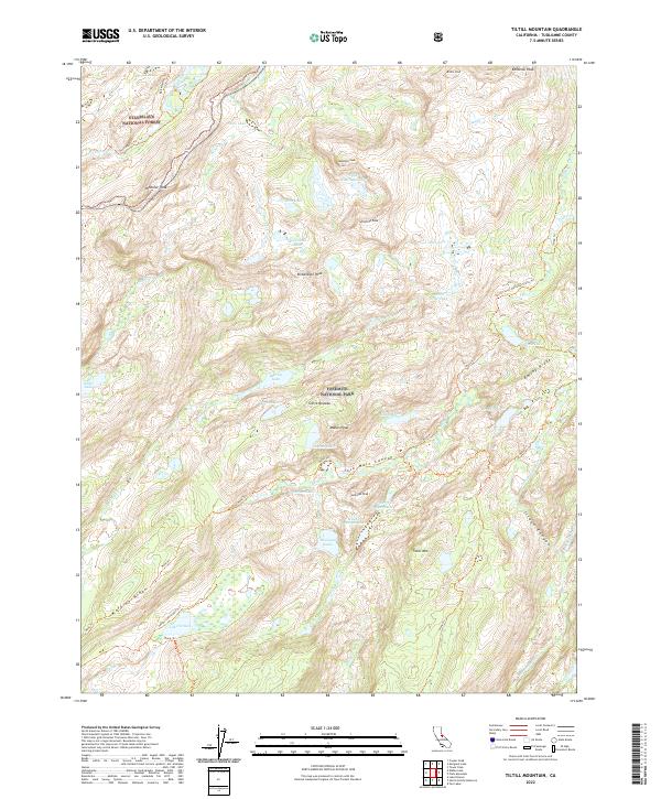
2022 Map of Tiltill Mountain
USGS Topo · Published 2022About this map
Yosemite National Park and Stanislaus National Forest converge in this high-elevation corridor of the Sierra Nevada. The map details a complex drainage network where Falls Creek and Kendrick Creek carve through prominent features like Jack Main Canyon and Tilden Canyon. Named peaks such as Tiltill Mountain, Wheeler Peak, and Richardson Peak define the skyline, overlooking a landscape dotted with numerous alpine waters including Lake Vernon, Branigan Lake, and Wilma Lake.
Find a feature on this map
51 named features on this map. Tap any name to fly to it.
Don’t see what you’re looking for? This feature index may not catch every label — zoom into the map to look around manually.
Map Details
Editions of this 2022 Tiltill Mountain Map
This is the sole edition of this map. No revisions or reprints were ever made.
Other maps of this area

1896 · Dardanelles
USGS Topo · 1:125,000

1897 · Yosemite
USGS Topo · 1:125,000

1898 · Dardanelles
USGS Topo · 1:125,000

1900 · Yosemite
USGS Topo · 1:125,000

1903 · Yosemite
USGS Topo · 1:125,000

1909 · Yosemite
USGS Topo · 1:125,000

1947 · Mariposa
USGS Topo · 1:250,000

1948 · Walker Lake
USGS Topo · 1:250,000

1948 · Mariposa
USGS Topo · 1:250,000

1956 · Pinecrest
USGS Topo · 1:62,500