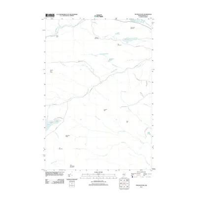
2011 Map of Tim Mountain
USGS Topo · Published 2011About this map
Tim Mountain and the Barnard Mountains dominate this high-country landscape in the Maine woods, where the drainage network of the N Branch Dead River shapes the local topography. This 2011 survey documents a region defined by its sporting heritage and timber history, centered around remote outposts like Tim Pond Camp and the Alder Stream Farm. The map reveals a complex system of logging and access roads, such as Alder Stream Rd and Tim Pond Rd, which connect the various ponds and ridges that have supported seasonal camps for generations. High points like Sawyer Hill Ridge and East Kennebago Mountain offer vantage points over a wilderness of interconnected waterways, including Tea Pond, Barnard Pond, and Tim Pond. The arrangement of these camps and roads provides an clear look at how human activity is organized around the natural catchments of Tim Brook and Lutton Brook.
Find a feature on this map
44 named features on this map. Tap any name to fly to it.
Don’t see what you’re looking for? This feature index may not catch every label — zoom into the map to look around manually.
Map Details
Editions of this 2011 Tim Mountain Map
This is the sole edition of this map. No revisions or reprints were ever made.
Other maps of this area

1928 · Chain Lakes
USGS Topo · 1:48,000

1928 · Spencer
USGS Topo · 1:48,000

1928 · Stratton
USGS Topo · 1:48,000

1932 · Stratton
USGS Topo · 1:62,500

1932 · Kennebago Lake
USGS Topo · 1:48,000

1932 · Spencer
USGS Topo · 1:62,500

1932 · Chain Lakes
USGS Topo · 1:62,500

1935 · Kennebago Lake
USGS Topo · 1:62,500

1935 · Chain Lakes
USGS Topo · 1:62,500

1936 · Kennebago Lake
USGS Topo · 1:62,500