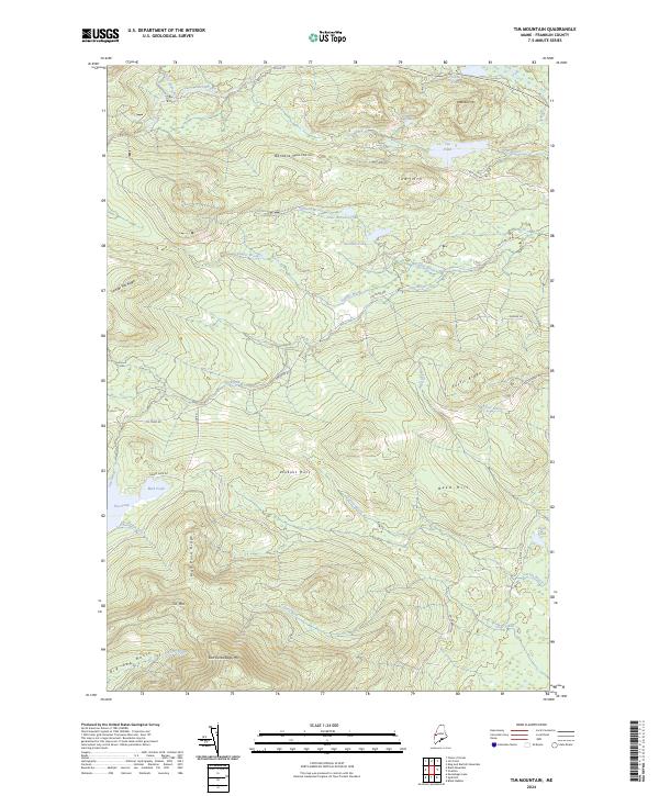
2024 Map of Tim Mountain
USGS Topo · Published 2024About this map
Tim Mtn and East Kennebago Mtn anchor this high-elevation landscape in Franklin County, where the terrain is defined by a series of prominent ridges and remote water bodies. The geography is dominated by the Barnard Mountains and Sawyer Hill Ridge, creating a complex network of drainages including Sawyer Brook and Tim Brook. In the northern section, Tea Pond and its smaller neighbor, Little Tea Pond, sit below the slopes of Tea Mtn, while Eustis Ridge provides a distinct overlook to the east. Transportation through this backcountry is limited to established logging and access routes such as Tim Pond Rd and Alder Stream Rd South Rd. The presence of the PVT R.O.W. J.P. Co. private right-of-way indicates the ongoing role of industrial timber management in shaping the modern accessibility of these peaks and basins.
Find a feature on this map
38 named features on this map. Tap any name to fly to it.
Don’t see what you’re looking for? This feature index may not catch every label — zoom into the map to look around manually.
Map Details
Editions of this 2024 Tim Mountain Map
This is the sole edition of this map. No revisions or reprints were ever made.
Other maps of this area

1928 · Chain Lakes
USGS Topo · 1:48,000

1928 · Spencer
USGS Topo · 1:48,000

1928 · Stratton
USGS Topo · 1:48,000

1932 · Stratton
USGS Topo · 1:62,500

1932 · Kennebago Lake
USGS Topo · 1:48,000

1932 · Spencer
USGS Topo · 1:62,500

1932 · Chain Lakes
USGS Topo · 1:62,500

1935 · Kennebago Lake
USGS Topo · 1:62,500

1935 · Chain Lakes
USGS Topo · 1:62,500

1936 · Kennebago Lake
USGS Topo · 1:62,500