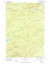
1970 Map of Tim Mountain
USGS Topo · Published 1973About this map
Tim Pond Camp sits at the edge of Tim Pond in this upland region of Franklin County, reflecting a landscape defined by seasonal sporting traditions and high-country timber management. The area is divided into historical township blocks such as Jim Pond and Tim Pond, where a network of jeep trails and the Tim Pond Lookout Road provide access to the summits of the Barnard Mountains and Tim Mountain.
Find a feature on this map
48 named features on this map. Tap any name to fly to it.
Don’t see what you’re looking for? This feature index may not catch every label — zoom into the map to look around manually.
Map Details
Editions of this 1970 Tim Mountain Map
This is the sole edition of this map. No revisions or reprints were ever made.
Other maps of this area

1928 · Chain Lakes
USGS Topo · 1:48,000

1928 · Spencer
USGS Topo · 1:48,000

1928 · Stratton
USGS Topo · 1:48,000

1932 · Stratton
USGS Topo · 1:62,500

1932 · Kennebago Lake
USGS Topo · 1:48,000

1932 · Spencer
USGS Topo · 1:62,500

1932 · Chain Lakes
USGS Topo · 1:62,500

1935 · Kennebago Lake
USGS Topo · 1:62,500

1935 · Chain Lakes
USGS Topo · 1:62,500

1936 · Kennebago Lake
USGS Topo · 1:62,500