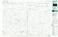
1986 Map of Timber Lake
USGS Topo · Published 1986About this map
The Grand River National Grassland and the Standing Rock Indian Reservation define much of this 1986 survey of north-central South Dakota. The landscape is characterized by its distinct geology, featuring prominent landmarks like Thunder Butte and Gray Butte, which rise above the drainages of the Moreau River and Grand River. In this era, small agricultural and rail-aligned settlements such as Isabel, Timber Lake, and Dupree serve as the primary hubs, connected by a network of roads and the remnants of an Old Railroad Grade. Industrial activity is noted through localized Strip Mines and a Quarry, while the presence of the Little Moreau State Recreation Area and various game production areas highlights the region's focus on conservation and outdoor land use. Numerous stock dams and small lakes, including Goose Creek Dam and Lake Walton, provide critical water management in this semi-arid prairie environment.
Find a feature on this map
62 named features on this map. Tap any name to fly to it.
Don’t see what you’re looking for? This feature index may not catch every label — zoom into the map to look around manually.
Map Details
Editions of this 1986 Timber Lake Map
2 editions found
Other maps of this area

1951 · Ridgeview NW
USGS Topo · 1:24,000

1951 · Redelm NE
USGS Topo · 1:24,000

1951 · Dupree NE
USGS Topo · 1:24,000

1951 · Redelm NW
USGS Topo · 1:24,000

1951 · Faith NE
USGS Topo · 1:24,000

1951 · Thunder Butte
USGS Topo · 1:24,000

1952 · Lantry NW
USGS Topo · 1:24,000

1952 · Whitehorse
USGS Topo · 1:24,000

1952 · Parade NE
USGS Topo · 1:24,000

1952 · Lantry NE
USGS Topo · 1:24,000