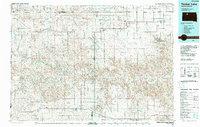
1986 Map of Timber Lake
USGS Topo · Published 1988About this map
The Moreau River and Grand River systems define this mid-1980s landscape across the Cheyenne River and Standing Rock Indian Reservations. This survey captures a region where the vast Grand River National Grassland meets a network of ranching and farming communities connected by a developing road infrastructure. Settlements such as Isabel, Timber Lake, and Eagle Butte serve as the primary hubs, while smaller locales like Glad Valley and Firesteel are situated near vital water resources such as Isabel Lake and Firesteel Creek. The map documents the industrial presence of Strip Mines and several small airstrips, including the McDaniel Landing Strip and Hunt Landing Strip, which reflect the remote transportation needs of north-central South Dakota. Significant conservation areas like the Little Moreau State Recreation Area contrast with the flat, expansive terrain of Pleasant Ridge and the Fairview plateau, illustrating the balance between public land management and agricultural life.
Find a feature on this map
53 named features on this map. Tap any name to fly to it.
Don’t see what you’re looking for? This feature index may not catch every label — zoom into the map to look around manually.
Map Details
Editions of this 1986 Timber Lake Map
2 editions found
Other maps of this area

1951 · Ridgeview NW
USGS Topo · 1:24,000

1951 · Redelm NE
USGS Topo · 1:24,000

1951 · Dupree NE
USGS Topo · 1:24,000

1951 · Redelm NW
USGS Topo · 1:24,000

1951 · Faith NE
USGS Topo · 1:24,000

1951 · Thunder Butte
USGS Topo · 1:24,000

1952 · Lantry NW
USGS Topo · 1:24,000

1952 · Whitehorse
USGS Topo · 1:24,000

1952 · Parade NE
USGS Topo · 1:24,000

1952 · Lantry NE
USGS Topo · 1:24,000