
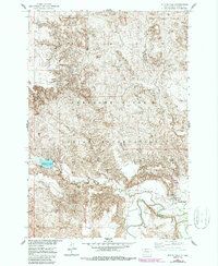
1952 Map of Whitehorse
USGS Topo · Published 1954About this map
The Cheyenne River Indian Reservation in Dewey County defines this early 1950s landscape, centered on the settlement of Whitehorse. This survey was conducted as part of a Department of the Interior program for the development of the Missouri River Basin, capturing the area's hydrology and small-scale infrastructure shortly after aerial photographs were taken in 1948. The terrain is marked by the winding course of the Moreau River and its confluence with the Little Moreau River to the south. Local landmarks like the Whitehorse Lake Spillway 1828 and a Flowing Well near the townsite indicate the critical importance of water management in this prairie environment. Genealogists may find interest in the local Cem located just north of the main settlement, providing a record of the community's footprint during this era of regional development.
Find a feature on this map
11 named features on this map. Tap any name to fly to it.
Don’t see what you’re looking for? This feature index may not catch every label — zoom into the map to look around manually.
Map Details
Editions of this 1952 Whitehorse Map
2 editions found
Other maps of this area

1951 · Ridgeview NW
USGS Topo · 1:24,000

1951 · Ridgeview NE
USGS Topo · 1:24,000

1952 · Parade NE
USGS Topo · 1:24,000

1952 · Glencross SE
USGS Topo · 1:24,000

1953 · McIntosh
USGS Topo · 1:250,000

1958 · McIntosh
USGS Topo · 1:250,000

1975 · Glencross
USGS Topo · 1:24,000
1975 · Glencross NE
USGS Topo · 1:24,000

1978 · Timber Lake
USGS Topo · 1:24,000

1978 · Little Moreau Lake
USGS Topo · 1:24,000