
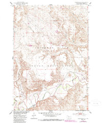
1952 Map of Glencross SE
USGS Topo · Published 1954About this map
The Moreau River meanders across the southern landscape of the Cheyenne River Indian Reservation, defining a terrain of river bends and drainage coulees. This mid-century survey reveals a rural community anchored by the St Pauls Ch and Emmanuel Ch, with the Emmanuel Cem serving as a primary site for genealogical interest.
Find a feature on this map
14 named features on this map. Tap any name to fly to it.
Don’t see what you’re looking for? This feature index may not catch every label — zoom into the map to look around manually.
Map Details
Editions of this 1952 Glencross SE Map
2 editions found
Other maps of this area

1951 · Ridgeview NW
USGS Topo · 1:24,000

1951 · Ridgeview NE
USGS Topo · 1:24,000

1951 · La Plant
USGS Topo · 1:24,000

1952 · Whitehorse
USGS Topo · 1:24,000

1952 · Trail City SW
USGS Topo · 1:24,000

1953 · McIntosh
USGS Topo · 1:250,000

1958 · McIntosh
USGS Topo · 1:250,000

1975 · Glencross
USGS Topo · 1:24,000

1975 · Trail City
USGS Topo · 1:24,000
1975 · Glencross NE
USGS Topo · 1:24,000