
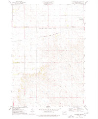
1975 Map of Trail City
USGS Topo · Published 1978About this map
Trail City sits at the junction of two South Dakota tribal territories, split by the Standing Rock Indian Reservation and Cheyenne River Indian Reservation boundary. This mid-1970s landscape is defined by the high, open terrain of the Ridgeland, which transitions into a complex network of drainages including Snake Creek to the northwest and the winding Du Charme Creek to the southeast. The Chicago Milwaukee St Paul and Pacific railroad cuts through the center of the townsite, marking the economic lifeline for the small community. Genealogists will find the Trail City Cem clearly marked just outside the main settlement. The geography is further articulated by water features such as Trail City Lake and Handboy Creek, reflecting the importance of water management in the rural Dakotas.
Find a feature on this map
13 named features on this map. Tap any name to fly to it.
Don’t see what you’re looking for? This feature index may not catch every label — zoom into the map to look around manually.
Map Details
Editions of this 1975 Trail City Map
This is the sole edition of this map. No revisions or reprints were ever made.
Other maps of this area

1951 · Promise
USGS Topo · 1:24,000

1952 · Trail City SW
USGS Topo · 1:24,000

1952 · Glencross SE
USGS Topo · 1:24,000

1953 · McIntosh
USGS Topo · 1:250,000

1956 · Wakpala SE
USGS Topo · 1:24,000

1956 · Little Eagle SE
USGS Topo · 1:24,000

1956 · Wakpala SW
USGS Topo · 1:24,000

1958 · McIntosh
USGS Topo · 1:250,000

1975 · Laundreaux Butte
USGS Topo · 1:24,000
1975 · Glencross NE
USGS Topo · 1:24,000