
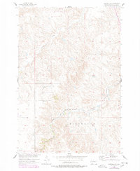
1956 Map of Wakpala SW
USGS Topo · Published 1957About this map
Wood Ridge Land dominates this part of the Missouri River Basin, characterized by the deeply incised drainage of Deep Bank Creek and the winding course of Snake Creek. The landscape is defined by its dramatic relief, notably at Skull Peak, which rises above the surrounding breaks. This 1956 field-checked survey reveals a territory where transportation is dictated by the challenging terrain, with the Chicago Milwaukee St Paul and Pacific railroad following the natural contours of the creek valleys to navigate the region. The map provides an intricate view of the local topography just as the Department of the Interior was intensifying development programs across the Missouri River Basin. This document captures the physical relationship between the heavy rail infrastructure and the serpentine waterways that carve through the high ridges of Corson County.
Find a feature on this map
5 named features on this map. Tap any name to fly to it.
Don’t see what you’re looking for? This feature index may not catch every label — zoom into the map to look around manually.
Map Details
Editions of this 1956 Wakpala SW Map
2 editions found
Other maps of this area

1953 · McIntosh
USGS Topo · 1:250,000

1956 · Wakpala NW
USGS Topo · 1:24,000

1956 · Little Eagle
USGS Topo · 1:24,000

1956 · Wakpala SE
USGS Topo · 1:24,000

1956 · Little Eagle SE
USGS Topo · 1:24,000

1956 · Wakpala
USGS Topo · 1:24,000

1958 · McIntosh
USGS Topo · 1:250,000

1975 · Laundreaux Butte
USGS Topo · 1:24,000

1975 · Trail City
USGS Topo · 1:24,000
1975 · Glencross NE
USGS Topo · 1:24,000