
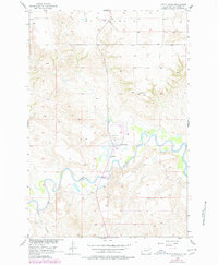
1956 Map of Little Eagle
USGS Topo · Published 1957About this map
The Grand River meanders across this mid-century landscape of the Standing Rock Indian Reservation, anchoring the settlement of Little Eagle. This 1956 field study, conducted as part of the Department of the Interior's Missouri River Basin development program, reveals a community centered around institutional anchors like St Pauls Ch and the adjacent St Pauls Cem. The map illustrates the town's position just north of the river's winding path, where Little Oak Creek joins the larger waterway.
Find a feature on this map
9 named features on this map. Tap any name to fly to it.
Don’t see what you’re looking for? This feature index may not catch every label — zoom into the map to look around manually.
Map Details
Editions of this 1956 Little Eagle Map
2 editions found
Other maps of this area

1953 · McIntosh
USGS Topo · 1:250,000

1956 · Little Eagle SW
USGS Topo · 1:24,000

1956 · Wakpala NW
USGS Topo · 1:24,000

1956 · Little Eagle SE
USGS Topo · 1:24,000

1956 · Little Eagle NW
USGS Topo · 1:24,000

1956 · Wakpala SW
USGS Topo · 1:24,000

1958 · McIntosh
USGS Topo · 1:250,000

1966 · McLaughlin
USGS Topo · 1:24,000

1966 · Mahto
USGS Topo · 1:24,000

1971 · McLaughlin SW
USGS Topo · 1:24,000