
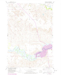
1956 Map of Wakpala NW
USGS Topo · Published 1957About this map
The Grand River meanders through this portion of Corson County, shaping a landscape of deep banks and floodplain pockets during the mid-1950s. This survey was conducted as part of the Department of the Interior's program for the development of the Missouri River Basin, capturing the area before significant hydrologic changes impacted the region. Near the river's winding path, local history is preserved at Long Hill Cem and Sacred Heart Cem, which stand as quiet markers of the community's ancestral ties.
Find a feature on this map
7 named features on this map. Tap any name to fly to it.
Don’t see what you’re looking for? This feature index may not catch every label — zoom into the map to look around manually.
Map Details
Editions of this 1956 Wakpala NW Map
2 editions found
Other maps of this area

1953 · McIntosh
USGS Topo · 1:250,000

1956 · Little Eagle
USGS Topo · 1:24,000

1956 · Wakpala SE
USGS Topo · 1:24,000

1956 · Little Eagle SE
USGS Topo · 1:24,000

1956 · Wakpala SW
USGS Topo · 1:24,000

1956 · Wakpala
USGS Topo · 1:24,000

1958 · McIntosh
USGS Topo · 1:250,000

1966 · McLaughlin
USGS Topo · 1:24,000

1966 · Mahto
USGS Topo · 1:24,000

1966 · Kline Buttes
USGS Topo · 1:24,000