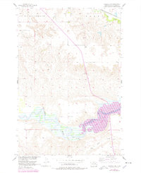
1956 Map of Wakpala NW
USGS Topo · Published 1978About this map
The Grand River flows through the southern portion of this landscape within the Standing Rock Indian Reservation, where the creation of Lake Oahe is documented through purple revision overlays. These updates, based on 1976 aerial photography, illustrate the rising water levels at elevation 1608 feet, significantly altering the river valley compared to the original 1956 field checks. Cultural landmarks like Long Hill Cem and Sacred Heart Cem are situated on the higher ground north of the river, providing valuable points of reference for local historians and genealogists.
Find a feature on this map
25 named features on this map. Tap any name to fly to it.
Don’t see what you’re looking for? This feature index may not catch every label — zoom into the map to look around manually.
Map Details
Editions of this 1956 Wakpala NW Map
2 editions found
Other maps of this area

1953 · McIntosh
USGS Topo · 1:250,000

1956 · Wakpala NW
USGS Topo · 1:24,000

1956 · Little Eagle
USGS Topo · 1:24,000

1956 · Wakpala SE
USGS Topo · 1:24,000

1956 · Little Eagle SE
USGS Topo · 1:24,000

1956 · Wakpala SW
USGS Topo · 1:24,000

1956 · Wakpala
USGS Topo · 1:24,000

1958 · McIntosh
USGS Topo · 1:250,000

1966 · McLaughlin
USGS Topo · 1:24,000

1966 · Mahto
USGS Topo · 1:24,000