
1956 Map of Wakpala
USGS Topo · Published 1957About this map
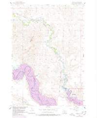
Oak Creek meanders across this mid-century landscape of northern South Dakota, converging with the Grand River near the town of Wakpala. The region is defined by the heavy presence of the Chicago Milwaukee St Paul and Pacific railroad, which follows the creek's drainage through the varied topography of the Wakpala and Mahto districts. Community life is anchored by the St Elizabeth Mission Home and the nearby St Bedes Cem. Of particular historical significance is the margin note indicating areas to be submerged by the Oahe Reservoir, marking a period of transition before the Missouri River Basin development altered the lowland features near Deep Bank Creek. The prominence of Rattlesnake Butte provides a constant natural landmark against the shifting human and hydraulic engineering of the era.
Find a feature on this map
11 named features on this map. Tap any name to fly to it.
Don’t see what you’re looking for? This feature index may not catch every label — zoom into the map to look around manually.
Map Details
Editions of this 1956 Wakpala Map
2 editions found
Other maps of this area

1953 · McIntosh
USGS Topo · 1:250,000

1956 · Wakpala NW
USGS Topo · 1:24,000

1956 · Wakpala SE
USGS Topo · 1:24,000

1956 · Wakpala SW
USGS Topo · 1:24,000

1958 · McIntosh
USGS Topo · 1:250,000

1966 · Mahto
USGS Topo · 1:24,000

1966 · Kenel
USGS Topo · 1:24,000

1966 · Kline Buttes
USGS Topo · 1:24,000

1967 · Mobridge NW
USGS Topo · 1:24,000

1967 · Mobridge
USGS Topo · 1:24,000