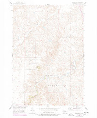
1956 Map of Wakpala SW
USGS Topo · Published 1978About this map
Standing Rock Indian Reservation covers the entirety of this landscape in Corson County, where the high plains terrain is defined by the prominent elevation of Skull Peak. The southern portion of the quadrangle is dominated by the massive Ridgeland plateau, a topographical feature that overlooks the winding course of Snake Creek as it cuts through the valley floor. This 1956 survey, updated with 1970s aerial data, provides a clear view of the infrastructure supporting the region's connectivity during the mid-20th century.
Find a feature on this map
6 named features on this map. Tap any name to fly to it.
Don’t see what you’re looking for? This feature index may not catch every label — zoom into the map to look around manually.
Map Details
Editions of this 1956 Wakpala SW Map
2 editions found
Other maps of this area

1953 · McIntosh
USGS Topo · 1:250,000

1956 · Wakpala NW
USGS Topo · 1:24,000

1956 · Little Eagle
USGS Topo · 1:24,000

1956 · Wakpala SE
USGS Topo · 1:24,000

1956 · Little Eagle SE
USGS Topo · 1:24,000

1956 · Wakpala SW
USGS Topo · 1:24,000

1956 · Wakpala
USGS Topo · 1:24,000

1958 · McIntosh
USGS Topo · 1:250,000

1975 · Laundreaux Butte
USGS Topo · 1:24,000

1975 · Trail City
USGS Topo · 1:24,000