
1975 Map of Laundreaux Butte
USGS Topo · Published 1976About this map
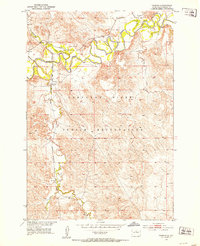
Laundreaux Butte serves as a central landmark in this mid-1970s landscape, situated within a vast expanse of Ridgeland that straddles the Corson and Dewey County line. The map highlights a significant administrative divide where the Standing Rock Indian Reservation Boundary meets the Cheyenne River Indian Reservation Boundary. The drainage patterns are defined by numerous seasonal waterways, including Laundreaux Creek, Deadman Creek, and Le Beau Creek, all of which contribute to the northern reaches of Lake Oahe.
Find a feature on this map
12 named features on this map. Tap any name to fly to it.
Don’t see what you’re looking for? This feature index may not catch every label — zoom into the map to look around manually.
Map Details
Editions of this 1975 Laundreaux Butte Map
This is the sole edition of this map. No revisions or reprints were ever made.
Other maps of this area
1951 · Promise
USGS Topo · 1:24,000

1952 · Trail City SW
USGS Topo · 1:24,000

1953 · McIntosh
USGS Topo · 1:250,000
1956 · Wakpala SE
USGS Topo · 1:24,000
1956 · Wakpala SW
USGS Topo · 1:24,000

1958 · McIntosh
USGS Topo · 1:250,000
1967 · Mobridge
USGS Topo · 1:24,000

1968 · Moreau NW
USGS Topo · 1:24,000

1968 · Moreau
USGS Topo · 1:24,000

1975 · Trail City
USGS Topo · 1:24,000