
1970 Map of Patch Skin Buttes
USGS Topo · Published 1972About this map
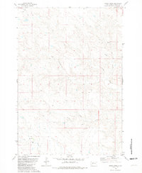
Patch Skin Buttes and the surrounding high plains of the Cheyenne River Indian Reservation dominate this landscape during the early 1970s. The map captures a transition in the Missouri River Basin, where the southeastern corner is marked by the presence of Lake Oahe, showing areas subject to controlled inundation. The terrain is defined by isolated topographic rises like Coffee Butte and Twin Buttes, while the drainage system is shaped by seasonal watercourses such as Buffalo Creek and Bird Creek. These features are indicative of the semi-arid ranching country of Dewey County, where water sources like a Flowing Well and localized Spring sites were critical landmarks for land management and navigation across the reservation.
Find a feature on this map
9 named features on this map. Tap any name to fly to it.
Don’t see what you’re looking for? This feature index may not catch every label — zoom into the map to look around manually.
Map Details
Editions of this 1970 Patch Skin Buttes Map
This is the sole edition of this map. No revisions or reprints were ever made.
Other maps of this area

1951 · Virginia
USGS Topo · 1:24,000

1951 · Promise
USGS Topo · 1:24,000

1953 · McIntosh
USGS Topo · 1:250,000

1958 · McIntosh
USGS Topo · 1:250,000

1968 · Moreau
USGS Topo · 1:24,000

1968 · Moreau SE
USGS Topo · 1:24,000

1969 · Patch Skin Buttes SW
USGS Topo · 1:24,000

1969 · Four Bear Creek
USGS Topo · 1:24,000

1969 · Patch Skin Buttes SE
USGS Topo · 1:24,000
1981 · Stove Creek
USGS Topo · 1:24,000