
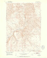
1951 Map of Virginia
USGS Topo · Published 1953About this map
Cheyenne River Indian Reservation lands dominate this mid-century landscape in Dewey County, where the winding course of Virginia Creek and Left Hand Creek cut through the undulating prairie. The area’s infrastructure is defined by the Chicago Milwaukee St Paul and Pacific railroad, which follows the natural corridor of the creek beds. This 1951 field-checked survey, produced as part of the Department of the Interior's Missouri River Basin development program, shows the sparse but critical markers of the local economy, including a prominent Gravel Pit. The map reveals the relationship between the railway and the local drainage systems, providing a clear record of the territory before significant modern development altered the remote landscape of the Dakotas.
Find a feature on this map
6 named features on this map. Tap any name to fly to it.
Don’t see what you’re looking for? This feature index may not catch every label — zoom into the map to look around manually.
Map Details
Editions of this 1951 Virginia Map
3 editions found
Other maps of this area

1951 · La Plant
USGS Topo · 1:24,000

1951 · Promise
USGS Topo · 1:24,000

1952 · Trail City SW
USGS Topo · 1:24,000

1953 · McIntosh
USGS Topo · 1:250,000

1958 · McIntosh
USGS Topo · 1:250,000

1968 · Moreau
USGS Topo · 1:24,000

1969 · Patch Skin Buttes SW
USGS Topo · 1:24,000

1970 · Patch Skin Buttes
USGS Topo · 1:24,000
1981 · Stove Creek
USGS Topo · 1:24,000
1981 · La Plant SW
USGS Topo · 1:24,000