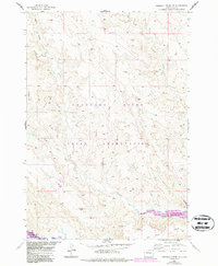
1956 Map of Herbert Creek SE
USGS Topo · Published 1987About this map
Cheyenne River Indian Reservation lands dominate this mid-century survey of the South Dakota landscape, mapped as part of a development program for the Missouri River Basin. The terrain is defined by a network of drainage channels including Beef Draw, Talcut Draw, and Olson Draw, all feeding into the meandering systems of Herbert Creek and Little Creek.
Find a feature on this map
13 named features on this map. Tap any name to fly to it.
Don’t see what you’re looking for? This feature index may not catch every label — zoom into the map to look around manually.
Map Details
Editions of this 1956 Herbert Creek SE Map
3 editions found
Other maps of this area

1954 · Pierre
USGS Topo · 1:250,000

1956 · Alleman Station
USGS Topo · 1:24,000

1956 · Rousseau Creek SW
USGS Topo · 1:24,000

1956 · Herbert Creek SE
USGS Topo · 1:24,000

1956 · Sansarc NE
USGS Topo · 1:24,000

1956 · Crockett Mountains
USGS Topo · 1:24,000

1958 · Pierre
USGS Topo · 1:250,000

1981 · Herbert Creek
USGS Topo · 1:24,000

1981 · Rousseau Creek NW
USGS Topo · 1:24,000

1981 · Herbert Creek NE
USGS Topo · 1:24,000