
1956 Map of Rousseau Creek SW
USGS Topo · Published 1957About this map
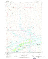
The Cheyenne River winds through this mid-century landscape on the border of Dewey and Stanley Counties, providing a critical water source for the livestock operations of the South Dakota plains. Family-held lands like Holloway Ranch and Chisholm Ranch are anchored near the riverbanks, while the High Elk Ranch sits further south. The map documents an important transition for the Missouri River Basin; areas along the river are marked to be submerged by the future Oahe Reservoir at an elevation of 1620 feet, signaling the coming change to this riparian environment.
Find a feature on this map
15 named features on this map. Tap any name to fly to it.
Don’t see what you’re looking for? This feature index may not catch every label — zoom into the map to look around manually.
Map Details
Editions of this 1956 Rousseau Creek SW Map
3 editions found
Other maps of this area

1954 · Pierre
USGS Topo · 1:250,000

1956 · Herbert Creek SE
USGS Topo · 1:24,000

1956 · Sansarc NE
USGS Topo · 1:24,000

1956 · Crockett Mountains
USGS Topo · 1:24,000

1958 · Pierre
USGS Topo · 1:250,000

1969 · Rousseau Creek
USGS Topo · 1:24,000

1981 · Charlie Creek
USGS Topo · 1:24,000

1981 · Rousseau Creek NW
USGS Topo · 1:24,000

1981 · Herbert Creek NE
USGS Topo · 1:24,000

1982 · Mission Ridge
USGS Topo · 1:24,000