
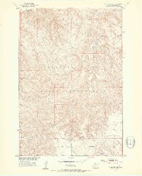
1951 Map of Ridgeview NE
USGS Topo · Published 1987About this map
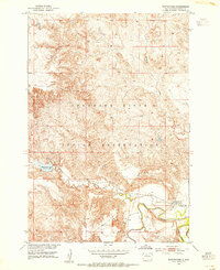
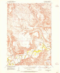
The Cheyenne River Indian Reservation encompasses this section of Dewey County, where the high plains are deeply incised by the drainage systems of the north. The Moreau River flows through the northern reaches of the quadrangle, carving a wide, undulating valley floor defined by intricate contour lines that reveal a complex system of bluffs and breaks. This landscape is a product of the Missouri River Basin development program, reflecting the topographic reality of the region in the early 1950s with later updates to road and infrastructure data.
Find a feature on this map
7 named features on this map. Tap any name to fly to it.
Don’t see what you’re looking for? This feature index may not catch every label — zoom into the map to look around manually.
Map Details
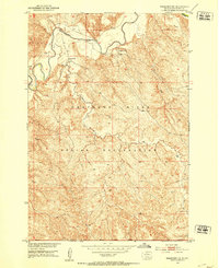
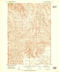
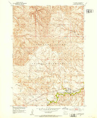
Editions of this 1951 Ridgeview NE Map
3 editions found
Other maps of this area
1951 · Ridgeview NW
USGS Topo · 1:24,000
1951 · Ridgeview NE
USGS Topo · 1:24,000
1951 · La Plant
USGS Topo · 1:24,000
1952 · Whitehorse
USGS Topo · 1:24,000

1952 · Trail City SW
USGS Topo · 1:24,000
1952 · Glencross SE
USGS Topo · 1:24,000

1953 · McIntosh
USGS Topo · 1:250,000

1958 · McIntosh
USGS Topo · 1:250,000

1981 · La Plant SW
USGS Topo · 1:24,000

1981 · Ridgeview
USGS Topo · 1:24,000