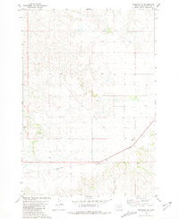
1981 Map of Ridgeview SW
USGS Topo · Published 1981About this map
St Basils Ch and an adjacent Cem serve as a central landmark in this 1980s landscape of the Cheyenne River Indian Reservation. The area is defined by a network of ranching outposts such as Gesinger Ranch, Simon Ranch, and Veo Ranch, which are connected by roads and drainage systems. The small settlements of Mossman and Rousseau sit along a primary transit corridor, while the drainage of Goose Creek and the West Branch Rousseau Cr carve through the high plains topography. A significant feature of this era's transportation network is the presence of an abandoned rail line or roadway cutting across the southern half of the map, signaling a shift in the region's infrastructure. Notable for genealogists, the map also identifies an isolated Grave located north of the Mossman area.
Find a feature on this map
15 named features on this map. Tap any name to fly to it.
Don’t see what you’re looking for? This feature index may not catch every label — zoom into the map to look around manually.
Map Details
Editions of this 1981 Ridgeview SW Map
This is the sole edition of this map. No revisions or reprints were ever made.
Other maps of this area

1951 · Ridgeview NW
USGS Topo · 1:24,000

1951 · Ridgeview NE
USGS Topo · 1:24,000

1952 · Parade NE
USGS Topo · 1:24,000

1953 · McIntosh
USGS Topo · 1:250,000

1954 · Pierre
USGS Topo · 1:250,000

1958 · Pierre
USGS Topo · 1:250,000

1958 · McIntosh
USGS Topo · 1:250,000

1981 · Charlie Creek
USGS Topo · 1:24,000

1981 · Rousseau Creek NW
USGS Topo · 1:24,000

1981 · Herbert Creek NE
USGS Topo · 1:24,000