
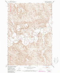
1952 Map of Parade NE
USGS Topo · Published 1954About this map
The Cheyenne River Indian Reservation dominates this 1952 topographic study, where the winding course of the Moreau River carves through the central landscape of South Dakota. This mid-century survey captures a rural environment defined by river bends and drainage systems like Redwater Creek and Goose Creek. Cultural landmarks are centered around the On-a-Tree Ch and its accompanying On-a-Tree Cem, providing specific points of interest for genealogists tracing families in this part of the Missouri River Basin. Another unnamed Cem is located further north. The map illustrates the complex topography of the prairie breaks leading down to the riverbanks, showing a terrain shaped by the confluence of the Cheyenne River and its tributaries before the extensive modern landscape changes of the later twentieth century.
Find a feature on this map
11 named features on this map. Tap any name to fly to it.
Don’t see what you’re looking for? This feature index may not catch every label — zoom into the map to look around manually.
Map Details
Editions of this 1952 Parade NE Map
2 editions found
Other maps of this area

1951 · Ridgeview NW
USGS Topo · 1:24,000

1952 · Whitehorse
USGS Topo · 1:24,000

1952 · Parade NW
USGS Topo · 1:24,000

1953 · McIntosh
USGS Topo · 1:250,000

1958 · McIntosh
USGS Topo · 1:250,000

1978 · Little Moreau Lake
USGS Topo · 1:24,000

1978 · Livermant Lake
USGS Topo · 1:24,000

1981 · Parade SW
USGS Topo · 1:24,000
1981 · Parade
USGS Topo · 1:24,000
1981 · Ridgeview SW
USGS Topo · 1:24,000