
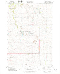
1978 Map of Brewer Butte
USGS Topo · Published 1979About this map
The Standing Rock Indian Reservation dominates the landscape of this late 1970s survey, illustrating the administrative and cultural boundaries of north-central South Dakota. The topography is defined by the winding course of the Little Moreau River and its seasonal drainage through High Bank Creek, which carve through the elevated plains of Little Oak and Fairview. A critical infrastructure element of the era is the Chicago Milwaukee St Paul and Pacific railroad line, which traverses the central portion of the map from east to west. Local geography is punctuated by prominent landmarks such as Brewer Butte and the shared boundary between Corson and Dewey counties. The presence of a Golf Course in the southeast corner provides a distinct contrast to the surrounding rural and reservation lands.
Find a feature on this map
14 named features on this map. Tap any name to fly to it.
Don’t see what you’re looking for? This feature index may not catch every label — zoom into the map to look around manually.
Map Details
Editions of this 1978 Brewer Butte Map
This is the sole edition of this map. No revisions or reprints were ever made.
Other maps of this area

1953 · McIntosh
USGS Topo · 1:250,000

1956 · Miscol SW
USGS Topo · 1:24,000

1956 · Black Horse SE
USGS Topo · 1:24,000

1956 · Miscol SE
USGS Topo · 1:24,000

1958 · McIntosh
USGS Topo · 1:250,000

1978 · Timber Lake
USGS Topo · 1:24,000

1978 · Peach Lake
USGS Topo · 1:24,000

1978 · Little Moreau Lake
USGS Topo · 1:24,000

1978 · Livermant Lake
USGS Topo · 1:24,000
1978 · Firesteel
USGS Topo · 1:24,000