
1956 Map of Miscol SW
USGS Topo · Published 1957About this map
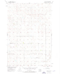
Lone Tree Sch and Little Oak Sch stand as the primary social and educational landmarks across this mid-century prairie landscape in Corson County. This survey, part of a Department of the Interior program for the development of the Missouri River Basin, reveals a sparsely settled region defined by section lines and natural drainages. The rural character of the Fairview township area is emphasized by the presence of Bank Creek and the drainage of Little Oak, which navigate the subtle topography of the high plains. The map illustrates a transitional era where traditional rural school districts still served the agricultural community before widespread consolidation. Researchers will find a precise rendering of the terrain and unimproved dirt roads that connected these isolated farmsteads during the 1950s.
Find a feature on this map
6 named features on this map. Tap any name to fly to it.
Don’t see what you’re looking for? This feature index may not catch every label — zoom into the map to look around manually.
Map Details
Editions of this 1956 Miscol SW Map
3 editions found
Other maps of this area

1953 · McIntosh
USGS Topo · 1:250,000

1956 · Black Horse NE
USGS Topo · 1:24,000

1956 · Black Horse SE
USGS Topo · 1:24,000

1956 · Miscol SE
USGS Topo · 1:24,000

1956 · Miscol
USGS Topo · 1:24,000

1956 · Miscol NE
USGS Topo · 1:24,000

1958 · McIntosh
USGS Topo · 1:250,000

1978 · Brewer Butte
USGS Topo · 1:24,000

1978 · Timber Lake
USGS Topo · 1:24,000
1978 · Firesteel
USGS Topo · 1:24,000