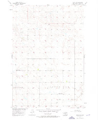
1956 Map of Miscol SW
USGS Topo · Published 1976About this map
High Bank Creek winds through this rural portion of Corson County, shaping a landscape defined by isolated homesteads and township divisions. Surveyed in the mid-1950s as part of a Department of the Interior program for the development of the Missouri River Basin, the map captures the region's sparse settlement pattern. Key community markers are limited to essential schoolhouses, such as Little Oak Sch and Lone Tree Sch, which served as the primary social and educational hubs for families across the Fairview and Little Oak districts. The map documents numerous individual elevation points and bench marks across the terrain, reflecting the detailed topographical work required for land management and water resource planning during this era of Midwestern development.
Find a feature on this map
5 named features on this map. Tap any name to fly to it.
Don’t see what you’re looking for? This feature index may not catch every label — zoom into the map to look around manually.
Map Details
Editions of this 1956 Miscol SW Map
3 editions found
Other maps of this area

1953 · McIntosh
USGS Topo · 1:250,000

1956 · Miscol SW
USGS Topo · 1:24,000

1956 · Black Horse NE
USGS Topo · 1:24,000

1956 · Black Horse SE
USGS Topo · 1:24,000

1956 · Miscol SE
USGS Topo · 1:24,000

1956 · Miscol
USGS Topo · 1:24,000

1956 · Miscol NE
USGS Topo · 1:24,000

1958 · McIntosh
USGS Topo · 1:250,000

1978 · Brewer Butte
USGS Topo · 1:24,000

1978 · Timber Lake
USGS Topo · 1:24,000