
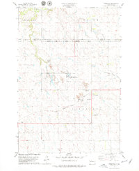
1978 Map of Peach Lake
USGS Topo · Published 1979About this map
The Peach Lake region of Dewey County unfolds as a landscape defined by intermittent watercourses and the high ground of the Firesteel terrain. This 1970s survey, conducted just before its publication in the late seventies, illustrates the sparse drainage network typical of the Cheyenne River Indian Reservation. The map tracks the winding paths of Meadow Creek as it meanders across the central and southern sections, while Redwater Creek drains the eastern portion of the quadrangle. In the southwest, the headwaters of Red Earth Creek provide a localized look at the area's hydrology. The small, named body of Peach Lake serves as a primary landmark in an otherwise open prairie environment, offering a clear reference point for those studying the physical geography of this portion of South Dakota.
Find a feature on this map
5 named features on this map. Tap any name to fly to it.
Don’t see what you’re looking for? This feature index may not catch every label — zoom into the map to look around manually.
Map Details
Editions of this 1978 Peach Lake Map
This is the sole edition of this map. No revisions or reprints were ever made.
Other maps of this area

1952 · Lantry NW
USGS Topo · 1:24,000

1952 · Lantry NE
USGS Topo · 1:24,000

1952 · Parade NW
USGS Topo · 1:24,000

1953 · McIntosh
USGS Topo · 1:250,000

1958 · McIntosh
USGS Topo · 1:250,000

1978 · Brewer Butte
USGS Topo · 1:24,000

1978 · Isabel SW
USGS Topo · 1:24,000

1978 · Isabel
USGS Topo · 1:24,000

1978 · Livermant Lake
USGS Topo · 1:24,000
1978 · Firesteel
USGS Topo · 1:24,000