
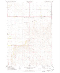
1975 Map of Glencross
USGS Topo · Published 1978About this map
Standing Rock Indian Reservation and the Cheyenne River Indian Reservation meet along a prominent boundary line in this Dewey County landscape. The settlement of Glencross serves as the focal point of the region, situated along the tracks of the Chicago Milwaukee St Paul and Pacific railroad. This rail corridor was essential to the transport economy of north-central South Dakota during the mid-1970s, connecting small prairie outposts to larger markets.
Find a feature on this map
11 named features on this map. Tap any name to fly to it.
Don’t see what you’re looking for? This feature index may not catch every label — zoom into the map to look around manually.
Map Details
Editions of this 1975 Glencross Map
This is the sole edition of this map. No revisions or reprints were ever made.
Other maps of this area

1952 · Whitehorse
USGS Topo · 1:24,000

1952 · Glencross SE
USGS Topo · 1:24,000

1953 · McIntosh
USGS Topo · 1:250,000

1956 · Little Eagle SW
USGS Topo · 1:24,000

1956 · Little Eagle SE
USGS Topo · 1:24,000

1956 · Miscol SE
USGS Topo · 1:24,000

1958 · McIntosh
USGS Topo · 1:250,000
1975 · Glencross NE
USGS Topo · 1:24,000

1978 · Timber Lake
USGS Topo · 1:24,000

1978 · Little Moreau Lake
USGS Topo · 1:24,000