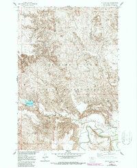
1952 Map of Whitehorse
USGS Topo · Published 1987About this map
The Cheyenne River Indian Reservation landscape is defined by the winding course of the Moreau River and its tributary, the Little Moreau River. This mid-century survey, updated in the 1980s, captures the settlement of Whitehorse positioned on the northern banks where the river bends sharply. The terrain is a complex network of draws and ridges, punctuated by essential water management features like the Whitehorse Lake Spillway 1828.
Find a feature on this map
8 named features on this map. Tap any name to fly to it.
Don’t see what you’re looking for? This feature index may not catch every label — zoom into the map to look around manually.
Map Details
Editions of this 1952 Whitehorse Map
2 editions found
Other maps of this area

1951 · Ridgeview NW
USGS Topo · 1:24,000

1951 · Ridgeview NE
USGS Topo · 1:24,000

1952 · Whitehorse
USGS Topo · 1:24,000

1952 · Parade NE
USGS Topo · 1:24,000

1952 · Glencross SE
USGS Topo · 1:24,000

1953 · McIntosh
USGS Topo · 1:250,000

1958 · McIntosh
USGS Topo · 1:250,000

1975 · Glencross
USGS Topo · 1:24,000
1975 · Glencross NE
USGS Topo · 1:24,000

1978 · Timber Lake
USGS Topo · 1:24,000