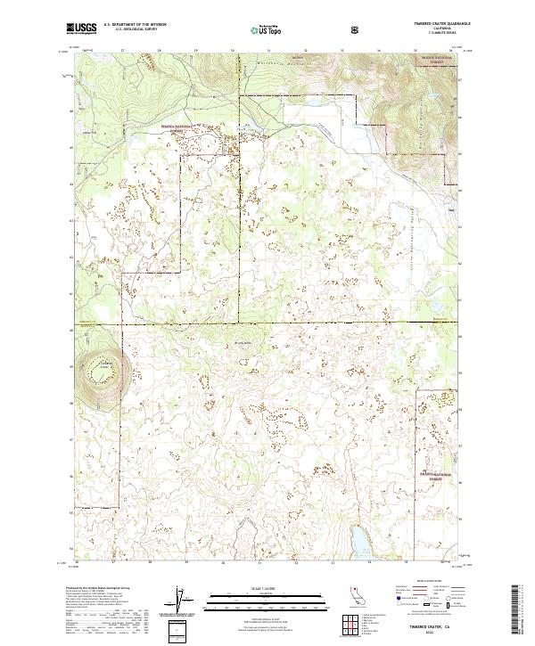
2022 Map of Timbered Crater
USGS Topo · Published 2022About this map
Timbered Crater and Brushy Butte dominate this volcanic landscape at the intersection of Shasta, Siskiyou, and Modoc counties. The terrain is defined by the transitions between the Shasta National Forest and the Modoc National Forest, where the higher elevations of the Whitehorse Mountains and Big Valley Mountains overlook the drainage basins of Little Hot Spring Valley. This area preserves evidence of geologically recent activity, notably highlighted by the Spatter Cone Loop Trl near the southern edge of the sheet. Water sources are critical but scattered in this high country, including Bluebrush Spring, the Gassaway Reservoir, and Horr Pond, which sits at the terminus of the Lava Springs Trl. The map also traces the path of the Pit Gas Pipe, indicating the modern industrial infrastructure that traverses this sparsely populated timber and volcanic range.
Find a feature on this map
25 named features on this map. Tap any name to fly to it.
Don’t see what you’re looking for? This feature index may not catch every label — zoom into the map to look around manually.
Map Details
Editions of this 2022 Timbered Crater Map
This is the sole edition of this map. No revisions or reprints were ever made.
Other maps of this area

1886 · Modoc Lava Bed
USGS Topo · 1:250,000

1892 · Modoc Lava-Bed
USGS Topo · 1:250,000

1932 · Bartle
USGS Topo · 1:96,000

1939 · Bartle
USGS Topo · 1:125,000

1954 · Alturas
USGS Topo · 1:250,000

1958 · Alturas
USGS Topo · 1:250,000

1961 · Hambone
USGS Topo · 1:62,500

1961 · Pondosa
USGS Topo · 1:62,500

1961 · Fall River Mills
USGS Topo · 1:62,500

1962 · Alturas
USGS Topo · 1:250,000