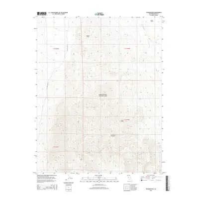
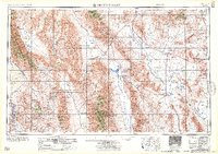
2015 Map of Tin Mountain
USGS Topo · Published 2015About this map
Tin Mtn stands as the prominent peak in this high-elevation landscape of Inyo County, situated where the northern Panamint Range meets the Cottonwood Mountains. Located entirely within Death Valley National Park, the terrain transitions from the arid flats of the Mojave Desert into steep, dissected ridges. The map captures the remote infrastructure of the park during the 2010s, centered on the unpaved corridor of Racetrack Valley Rd. This thoroughfare provides the primary access through the desert valleys, connecting high-country basins to the drainage systems of Little Grapevine Cr and the wider Death Valley Wash. The survey illustrates the stark land-management boundaries of the early 21st century, showing the precise township and range divisions that overlay this protected wilderness area.
Find a feature on this map
13 named features on this map. Tap any name to fly to it.
Don’t see what you’re looking for? This feature index may not catch every label — zoom into the map to look around manually.
Map Details
Editions of this 2015 Tin Mountain Map
This is the sole edition of this map. No revisions or reprints were ever made.
Other maps of this area
1908 · Lida
USGS Topo · 1:250,000

1908 · Ballarat
USGS Topo · 1:250,000
1913 · Lida
USGS Topo · 1:250,000

1913 · Ballarat
USGS Topo · 1:250,000

1948 · Death Valley
USGS Topo · 1:250,000

1954 · Death Valley
USGS Topo · 1:250,000

1954 · Goldfield
USGS Topo · 1:250,000
1955 · Goldfield
USGS Topo · 1:250,000

1956 · Death Valley
USGS Topo · 1:250,000
1957 · Death Valley
USGS Topo · 1:250,000