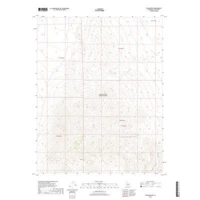
2018 Map of Tin Mountain
USGS Topo · Published 2018About this map
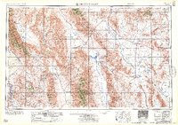
Tin Mtn stands as a prominent summit within the high-altitude landscape of the Cottonwood Mountains, where the elevation changes dramatically across the northern reaches of the Mojave Desert. This 2018 survey detail shows a transition between the craggy peaks and the alluvial drainages that feed into Death Valley. Within the boundaries of Death Valley National Park, the map traces the deep incisions of Bighorn Gorge and the ephemeral watercourses of Little Grapevine Cr and Death Valley Wash. The topographic detail illustrates the classic basin and range structure of Inyo County, providing a clear picture of the landforms that define the eastern edge of the state as they were mapped in the early 21st century.
Find a feature on this map
12 named features on this map. Tap any name to fly to it.
Don’t see what you’re looking for? This feature index may not catch every label — zoom into the map to look around manually.
Map Details
Editions of this 2018 Tin Mountain Map
This is the sole edition of this map. No revisions or reprints were ever made.
Other maps of this area
1908 · Lida
USGS Topo · 1:250,000

1908 · Ballarat
USGS Topo · 1:250,000
1913 · Lida
USGS Topo · 1:250,000

1913 · Ballarat
USGS Topo · 1:250,000

1948 · Death Valley
USGS Topo · 1:250,000

1954 · Death Valley
USGS Topo · 1:250,000

1954 · Goldfield
USGS Topo · 1:250,000
1955 · Goldfield
USGS Topo · 1:250,000

1956 · Death Valley
USGS Topo · 1:250,000
1957 · Death Valley
USGS Topo · 1:250,000