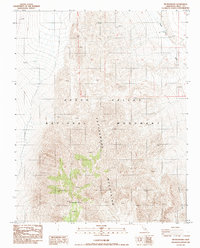
1988 Map of Tin Mountain
USGS Topo · Published 1988About this map
Tin Mountain rises as the central landmark within this 1988 survey of the Cottonwood Mountains, located within the desert landscape of the Death Valley National Monument. The map detail follows the sharp elevation changes of the high peaks and deep drainage systems that define this part of Inyo County. Major watercourses like Death Valley Wash and the steep Bighorn Gorge carve through the terrain, illustrating the geological forces at work in the high desert. This provisional edition was compiled from 1980 photography and field checked in 1983, documenting the primitive roads and trails that traverse the wilderness before its later redesignation as a National Park.
Find a feature on this map
5 named features on this map. Tap any name to fly to it.
Don’t see what you’re looking for? This feature index may not catch every label — zoom into the map to look around manually.
Map Details
Editions of this 1988 Tin Mountain Map
This is the sole edition of this map. No revisions or reprints were ever made.
Other maps of this area

1908 · Lida
USGS Topo · 1:250,000

1908 · Ballarat
USGS Topo · 1:250,000

1913 · Lida
USGS Topo · 1:250,000

1913 · Ballarat
USGS Topo · 1:250,000

1948 · Death Valley
USGS Topo · 1:250,000

1954 · Death Valley
USGS Topo · 1:250,000

1954 · Goldfield
USGS Topo · 1:250,000

1955 · Goldfield
USGS Topo · 1:250,000

1956 · Death Valley
USGS Topo · 1:250,000

1957 · Death Valley
USGS Topo · 1:250,000