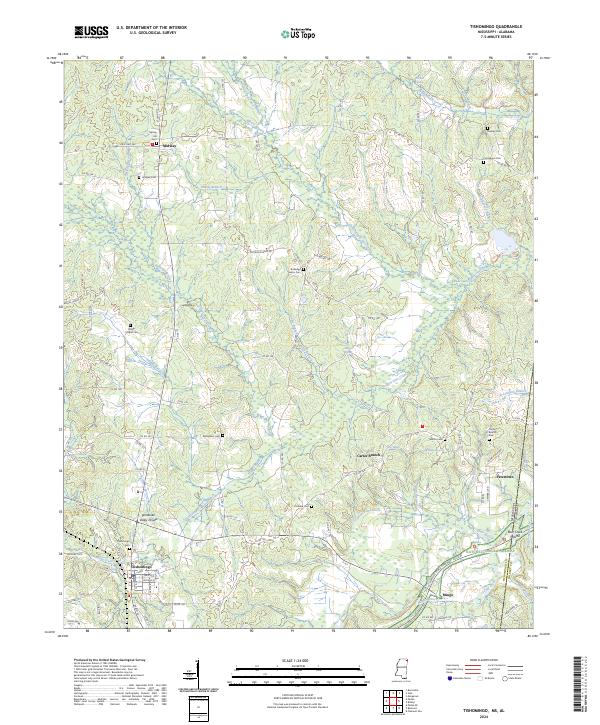
2024 Map of Tishomingo
USGS Topo · Published 2024About this map
Tishomingo serves as a primary hub in this corner of Mississippi, situated south of the Tennessee Valley Divide. The landscape is defined by its complex network of watercourses, including Bear Creek and Cripple Deer Creek, which weave through the townships. For those tracing local lineage, numerous small burial grounds like Spring Hill Cem and Boggs Chapel Cem are documented alongside crossroads communities like Midway and Petertown. The map also captures the path of the Natchez Trace Parkway as it cuts through the southern portion of the quadrangle near Mingo. This 2024 survey illustrates the modern road network, from State Hwy 364 to local routes like Boggs Chapel Rd, reflecting the persistent settlement patterns of Tishomingo County and the nearby Alabama state line.
Find a feature on this map
57 named features on this map. Tap any name to fly to it.
Don’t see what you’re looking for? This feature index may not catch every label — zoom into the map to look around manually.
Map Details
Editions of this 2024 Tishomingo Map
This is the sole edition of this map. No revisions or reprints were ever made.
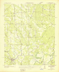
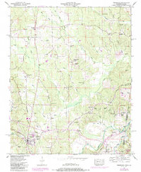
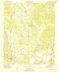
Historical Maps of Midway Through Time
4 maps found