2024 Map of Toccoa
USGS Topo · Published 2024About this map
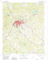
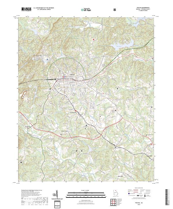
The Stephens County Courthouse serves as the focal point for this area of Northeast Georgia, where the foothills of the Chattahoochee National Forest meet the growing residential and industrial corridors of Toccoa. The map reveals a landscape defined by its water and history, from the high grounds of Rock Quarry Mtn to the shoreline of Hartwell Lake. The presence of Toccoa Falls College and several established neighborhoods like Fowlertown and Carnes Creek illustrate the enduring settlement patterns around the historic city center.
Find a feature on this map
233 named features on this map. Tap any name to fly to it.
Don’t see what you’re looking for? This feature index may not catch every label — zoom into the map to look around manually.
Map Details
Editions of this 2024 Toccoa Map
This is the sole edition of this map. No revisions or reprints were ever made.
Historical Maps of Fowlertown Through Time
3 maps found