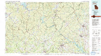
1981 Map of Toccoa
USGS Topo · Published 1982About this map
The Blue Ridge mountains dominate this tri-state landscape where Georgia, South Carolina, and North Carolina converge. This 1981 compilation, based on decades of topographical data, reveals a region defined by its protected lands and intricate waterway systems. Significant conservation areas like the Chattahoochee National Forest, Sumter National Forest, and Nantahala National Forest create a nearly continuous canopy across the highland terrain. The map captures the hydroelectric and recreational development of the era, from the deep waters of Lake Burton and Lake Rabun to the expansive Hartwell Lake on the southeastern edge. Within these valleys, historic settlements such as Dahlonega and Toccoa serve as anchors for the rural road network. The rugged geography is further detailed through specialized areas like the Tallulah Gorge State Park and the pristine Ellicott Rock Wilderness, where the three states meet at a single point.
Find a feature on this map
50 named features on this map. Tap any name to fly to it.
Don’t see what you’re looking for? This feature index may not catch every label — zoom into the map to look around manually.
Map Details
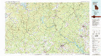
Editions of this 1981 Toccoa Map
2 editions found
Other maps of this area

1886 · Dahlonega
USGS Topo · 1:125,000

1886 · Walhalla
USGS Topo · 1:125,000

1888 · Ellijay
USGS Topo · 1:125,000

1888 · Pickens
USGS Topo · 1:125,000

1890 · Suwanee
USGS Topo · 1:125,000

1891 · Cowee
USGS Topo · 1:125,000

1891 · Gainesville
USGS Topo · 1:125,000

1891 · Carnesville
USGS Topo · 1:125,000

1892 · Dahlonega
USGS Topo · 1:125,000

1892 · Walhalla
USGS Topo · 1:125,000