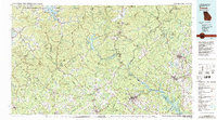
1981 Map of Toccoa
USGS Topo · Published 1982About this map
The Blue Ridge mountains dominate this 1981 survey, where the borders of Georgia, South Carolina, and North Carolina converge. This landscape is defined by the massive reservoirs and river systems that power and provide recreation for the region, including Chatuge Lake, Lake Burton, and the extensive reaches of Hartwell Lake. Significant conservation and forest lands like the Chattahoochee National Forest and Nantahala National Forest preserve the high-elevation terrain around peaks such as Long Mountain.
Find a feature on this map
71 named features on this map. Tap any name to fly to it.
Don’t see what you’re looking for? This feature index may not catch every label — zoom into the map to look around manually.
Map Details
Editions of this 1981 Toccoa Map
2 editions found
Other maps of this area

1886 · Dahlonega
USGS Topo · 1:125,000

1886 · Walhalla
USGS Topo · 1:125,000

1888 · Ellijay
USGS Topo · 1:125,000

1888 · Pickens
USGS Topo · 1:125,000

1890 · Suwanee
USGS Topo · 1:125,000

1891 · Cowee
USGS Topo · 1:125,000

1891 · Gainesville
USGS Topo · 1:125,000

1891 · Carnesville
USGS Topo · 1:125,000

1892 · Dahlonega
USGS Topo · 1:125,000

1892 · Walhalla
USGS Topo · 1:125,000