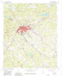
1964 Map of Toccoa
USGS Topo · Published 1981About this map
Toccoa stands as a busy rail and industrial center in the mid-1960s, anchored by the Southern Railway corridor and the institutional grounds of the Toccoa Falls Institute. The landscape is defined by the transition from the city's residential streets, such as those surrounding the Whitman Street High Sch, to the foothills of the Chattahoochee National Forest. Significant terrain features like Currahee Mountain and Rock Quarry Mountain loom over the Broad River drainage, where hydraulic infrastructure like Broad River Dam No. 1 reflects mid-century utility development.
Find a feature on this map
131 named features on this map. Tap any name to fly to it.
Don’t see what you’re looking for? This feature index may not catch every label — zoom into the map to look around manually.
Map Details
Editions of this 1964 Toccoa Map
2 editions found
Other maps of this area

1886 · Walhalla
USGS Topo · 1:125,000

1891 · Carnesville
USGS Topo · 1:125,000

1892 · Walhalla
USGS Topo · 1:125,000

1896 · Walhalla
USGS Topo · 1:125,000

1953 · Tallulah Falls
USGS Topo · 1:24,000

1954 · Greenville
USGS Topo · 1:250,000

1957 · Tugaloo Lake
USGS Topo · 1:24,000

1958 · Greenville
USGS Topo · 1:250,000

1960 · Martin
USGS Topo · 1:24,000
1963 · Holly Springs
USGS Topo · 1:24,000