Loading...
Loading map...2022 Map of Toco
USGS Topo · Published 2022About this map
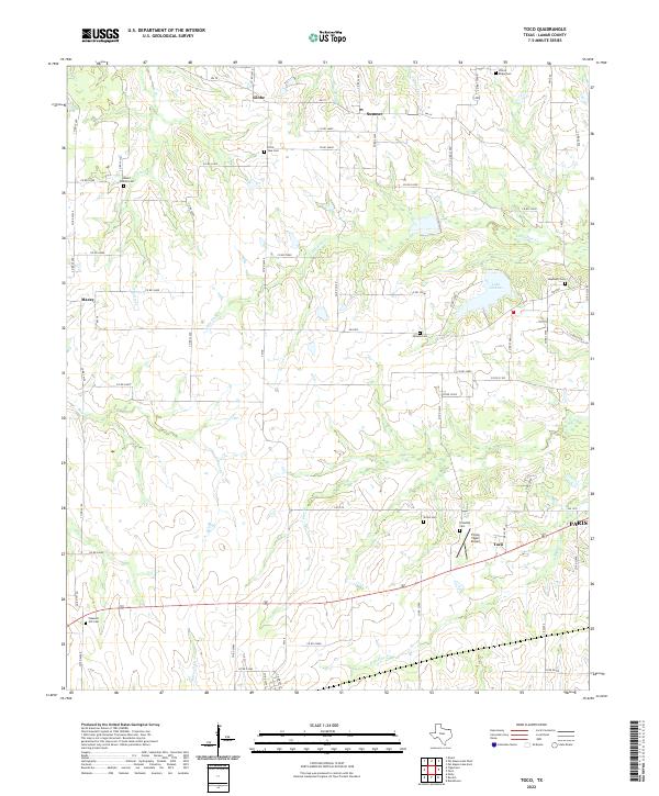
Paris and the surrounding Lamar County countryside are defined by a network of farm roads and drainage basins in this 2022 survey. Small settlements like Toco, Sumner, Maxey, and Globe anchor the rural landscape, which is heavily populated by family and community burial grounds such as Mount Vernon Cem, Shiloh Cem, and El Bethel Cem. These landmarks, often established in the 19th century, serve as significant markers of local genealogy and early settlement patterns.
Find a feature on this map
71 named features on this map. Tap any name to fly to it.
Don’t see what you’re looking for? This feature index may not catch every label — zoom into the map to look around manually.
Map Details
Date Portrayed2022
Date Published2022
PublisherU.S. Geological Survey
Map TypeTopographic
Scale1:24000
Physical Dimensions24 x 29 inches
Editions of this 2022 Toco Map
This is the sole edition of this map. No revisions or reprints were ever made.
Historical Maps of Paris Through Time
Featured Locations
Source Details
SourceU.S. Geological Survey
CopyrightPublic Domain