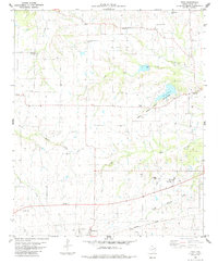
1984 Map of Toco
USGS Topo · Published 1985About this map
Brookston and Toco anchor the southern portion of this West Texas landscape, where the Missouri Pacific railroad corridor cuts across the lower margin. The area is defined by a dense network of watercourses including Little Pine Creek, Maxey Creek, and the South Branch Pine Creek, which feed into larger reservoirs like Lake Gibbons. This mid-1980s topography reveals a rural society built around small settlements like Sumner, Globe, and Maxey, interspersed with numerous community anchors such as Shiloh Cem, Jackson Cem, and Mt Vernon Cem.
Find a feature on this map
29 named features on this map. Tap any name to fly to it.
Don’t see what you’re looking for? This feature index may not catch every label — zoom into the map to look around manually.
Map Details
Editions of this 1984 Toco Map
This is the sole edition of this map. No revisions or reprints were ever made.
Other maps of this area

1903 · Paris
USGS Topo · 1:125,000

1947 · Honey Grove
USGS Topo · 1:62,500

1948 · Grant
USGS Topo · 1:62,500

1948 · Paris
USGS Topo · 1:62,500

1948 · Direct
USGS Topo · 1:62,500

1949 · Direct
USGS Topo · 1:62,500

1949 · Honey Grove
USGS Topo · 1:62,500

1949 · Grant
USGS Topo · 1:62,500

1949 · Paris
USGS Topo · 1:62,500

1953 · Texarkana
USGS Topo · 1:250,000