
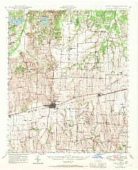
1947 Map of Honey Grove
USGS Topo · Published 1966About this map
Honey Grove serves as the central hub for this 1947 survey, where the Texas and Pacific RR bisects the landscape and anchors the local economy. The map illustrates a dense network of rural infrastructure along the Fannin Co Lamar Co line, characterized by a high frequency of neighborhood-based institutions like Michigan Prairie School, Green Chapel Church, and Swan Chapel Rock Hill School.
Find a feature on this map
71 named features on this map. Tap any name to fly to it.
Don’t see what you’re looking for? This feature index may not catch every label — zoom into the map to look around manually.
Map Details
Editions of this 1947 Honey Grove Map
2 editions found
Other maps of this area

1903 · Paris
USGS Topo · 1:125,000

1948 · Grant
USGS Topo · 1:62,500

1948 · Paris
USGS Topo · 1:62,500

1948 · Direct
USGS Topo · 1:62,500

1949 · Direct
USGS Topo · 1:62,500

1949 · Honey Grove
USGS Topo · 1:62,500

1949 · Grant
USGS Topo · 1:62,500

1949 · Paris
USGS Topo · 1:62,500

1953 · Texarkana
USGS Topo · 1:250,000

1954 · Sherman
USGS Topo · 1:250,000